Daocheng Yading: The Valley That Was Named After a Novel
Southwest
On this page
The bus drops you in a town called Shangri-La.
It says so on the sign. Shangri-La Town (香格里拉镇), about 2,900 metres up, a single strip of guesthouses and noodle shops at the mouth of a valley in western Sichuan. Until 2002 the place was called Riwa (日瓦). The name it wears now was invented in 1933 by an English novelist who never set foot in China.
Behind the town, up a road you are not allowed to drive yourself, stands a mountain of 6,032 metres that has had a name for twelve hundred years.
Both things are true at once, and the gap between them is the most interesting thing about Daocheng Yading. So let’s start with the name — where it came from, who sold it, and what it is sitting on top of. Then we’ll walk up.
A word out of a book
James Hilton published Lost Horizon in 1933: a hijacked plane, a crash in the mountains, a hidden lamasery in a valley where nobody grows old and nobody wants to leave. He called the valley Shangri-La. The book was an enormous hit, the word went straight into English, and within a decade an American president had named his weekend retreat after it — the place we now call Camp David.
Hilton had never been to China. He wrote the book in London, out of a library.
So where did he get the valley?
A man with a camera
The usual answer is Joseph Rock — an Austrian-American botanist and explorer who based himself in Lijiang for the better part of three decades and spent the 1920s and 30s pushing into the Sino-Tibetan borderlands with a caravan, a camera, and a spectacular sense of his own importance.
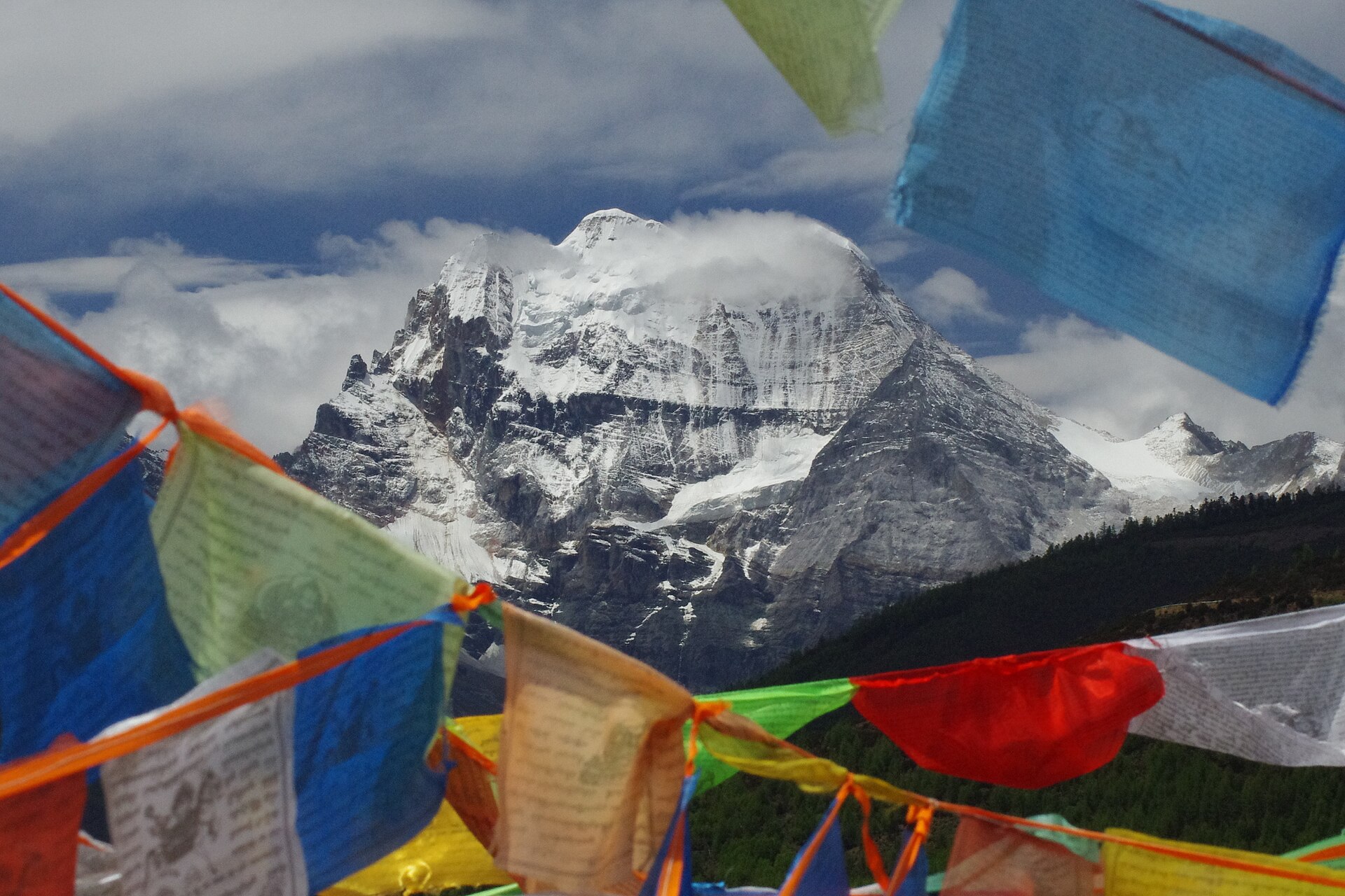
In 1928 he reached these three peaks. He stayed at Chonggu Monastery, photographed the mountains, and wrote the whole thing up for National Geographic — most famously in July 1931, under the irresistible headline “Konka Risumgongba, Holy Mountain of the Outlaws.” For Western readers it was the first real look at this corner of the world.
The theory goes: Hilton, in London, read Rock in the reading room, and built his valley out of Rock’s photographs.
Here’s the honest version, because we’d rather you had that than the brochure. Hilton never said so. Asked about his sources, he pointed at the nineteenth-century travel writing of the French missionary Abbé Huc, and at Shambhala, the hidden kingdom of Tibetan Buddhist tradition. The Rock connection was proposed decades later — first in the late 1970s by Xuan Ke, whose father had worked as Rock’s assistant, and argued in more detail afterwards by the American researcher Ted Vaill.
So: the dates line up. The photographs really do look like the place. And nobody has ever proved it. “Yading is the real Shangri-La” is a good story, widely repeated, and still a story.
The towns that renamed themselves
Once a word is worth money, people buy it.
Zhongdian, over in Yunnan, won the first round: in December 2001 it was formally renamed Shangri-La County (a city since 2014). Six weeks later, in January 2002, Daocheng’s Riwa township renamed itself Shangri-La as well — a township first, a town from 2009. Yading’s own marketing settled on the phrase you’ll see on every banner and bus ticket: “the last Shangri-La.”
None of this is a scandal, and we’re not sneering at it. A poor county in the mountains found a word that brought people and money, and used it. It’s just worth knowing that the name on the sign is a business decision roughly as old as euro banknotes — and that it is not what anyone here called this place before.
What the mountains were called first
Their real name is Nyainqên Konga Risumgonbo (念青贡嘎日松贡布), and it is about twelve hundred years older than the other one.
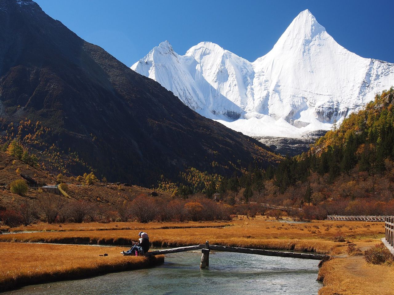
In the eighth century Padmasambhava — the master who carried tantric Buddhism into Tibet — is said to have consecrated the three peaks and named them the rigsum gonpo (三怙主), the Three Protectors. They stand in a rough triangle around the valley, and each one is a bodhisattva:
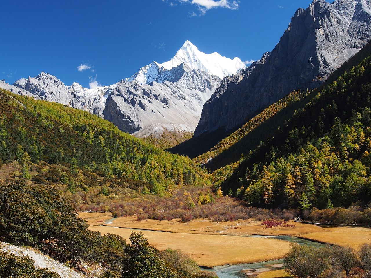
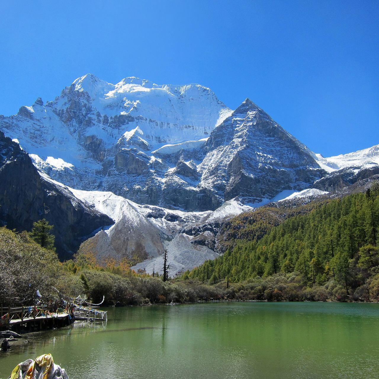
- Xiannairi / Chenresig (仙乃日), 6,032 m — Avalokiteshvara, compassion. The northern peak, and the highest thing here. It’s the one you see first, a broad white dome that looks less like a mountain than like something seated.
- Yangmaiyong / Jampelyang (央迈勇), 5,958 m — Manjushri, wisdom. The southern peak: a sheer, almost geometric pyramid that hides behind a ridge until suddenly it doesn’t. Most people’s favourite, once they’ve seen it.
- Xiaruoduoji / Chanadorje (夏诺多吉), 5,958 m — Vajrapani, power. The eastern peak, all rock and edge. The one most day-trippers never really look at.
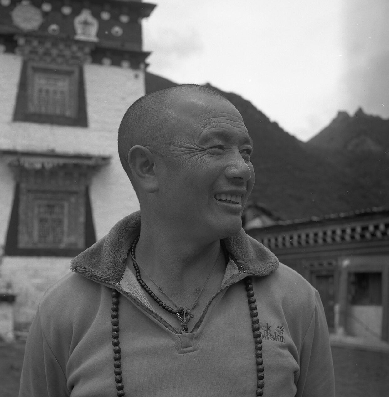
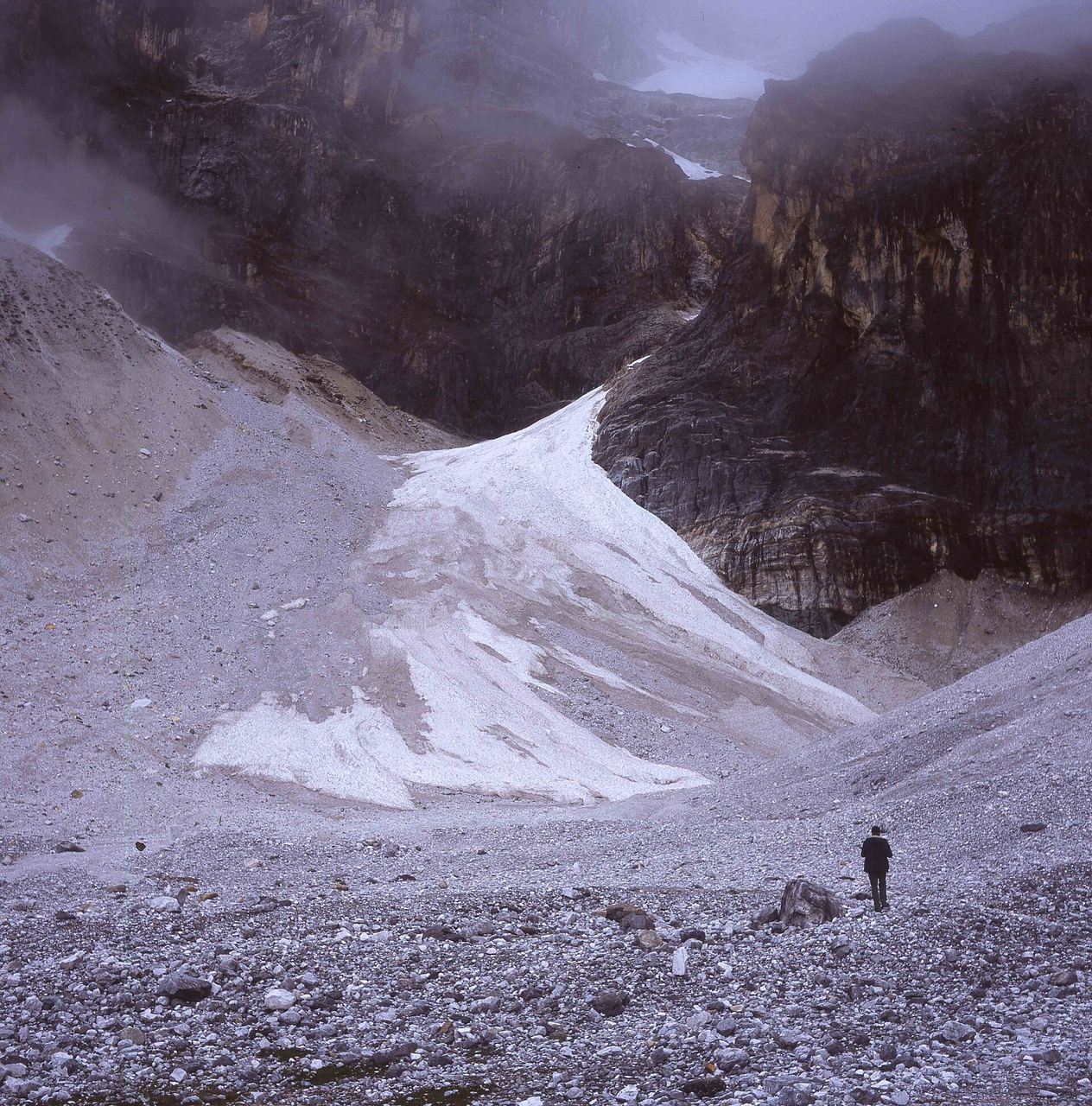
Tibetan tradition ranks the group eleventh among the twenty-four holy sites, and people have walked kora — the clockwise pilgrimage circuit — around them for centuries. The full outer circuit is currently closed to visitors, but on the valley paths you will still pass people who are quite obviously not sightseeing: walking with purpose, counting mantras, in for a longer day than yours.
A little etiquette, since you’re a guest in somebody’s holy place: walk clockwise around monasteries, stupas and mani stone piles. Don’t climb on prayer flags, move mani stones, or drape yourself over a chorten for a photo. Ask before photographing people. Inside the monastery, hats off, voices down, and don’t point at the images.
What the name doesn’t tell you: the numbers
Hilton’s valley was a place where nothing hurt. Here is the real one, in metres — and this ladder is the single most useful thing on this page:
| Where | Elevation |
|---|---|
| Shangri-La (Riwa) town — where you sleep | ~2,900 m |
| Daocheng town | ~3,750 m |
| Daocheng Yading Airport (DCY) | 4,411 m |
| Yading village — inside the gate | ~3,900 m |
| Chonggu Monastery — where the walking starts | ~3,900 m |
| Pearl Lake (Zhuomala Tso) | ~4,100 m |
| Luorong Pasture | ~4,150 m |
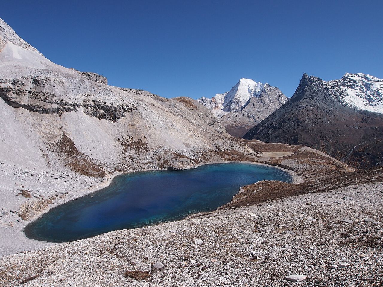
| Milk Sea (Niunai Hai) | ~4,600 m |
| Five Colour Lake (Wuse Hai) | ~4,700 m |
Read that airport line again. Daocheng Yading Airport sits at 4,411 metres — the highest civilian airport in the world, higher than anything you will walk to except the last two lakes. It is a ninety-minute hop from Chengdu and it is, physiologically, a trap: you go from 500 m to 4,411 m over lunch, with none of the acclimatisation the long road would have given you.
If you fly, go straight down. The drive from the airport to Shangri-La town is around 115–120 km and two to two and a half hours, and it drops you 1,500 metres. Sleep low. That single decision does more for your trip than anything else in this guide.
The valley, and the fork in it
From the gate a shuttle bus climbs roughly 38 km up to Zhaguanbeng, the road head — you can’t drive this stretch yourself. From there it’s a short walk to Chonggu Monastery, and the valley splits into the two routes everyone chooses between.
The short line goes to Pearl Lake (珍珠海), about 4,100 m, maybe forty minutes of boardwalk and steps from the monastery. It is a small green tarn directly beneath Xiannairi, and on a still morning the whole 6,032-metre peak lies flat on the surface of it. This is the gentle option, and it is not a consolation prize — plenty of people who grind their way to the high lakes tell you afterwards that Pearl Lake was the better hour.
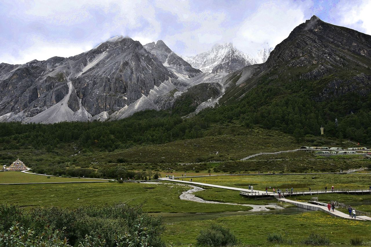
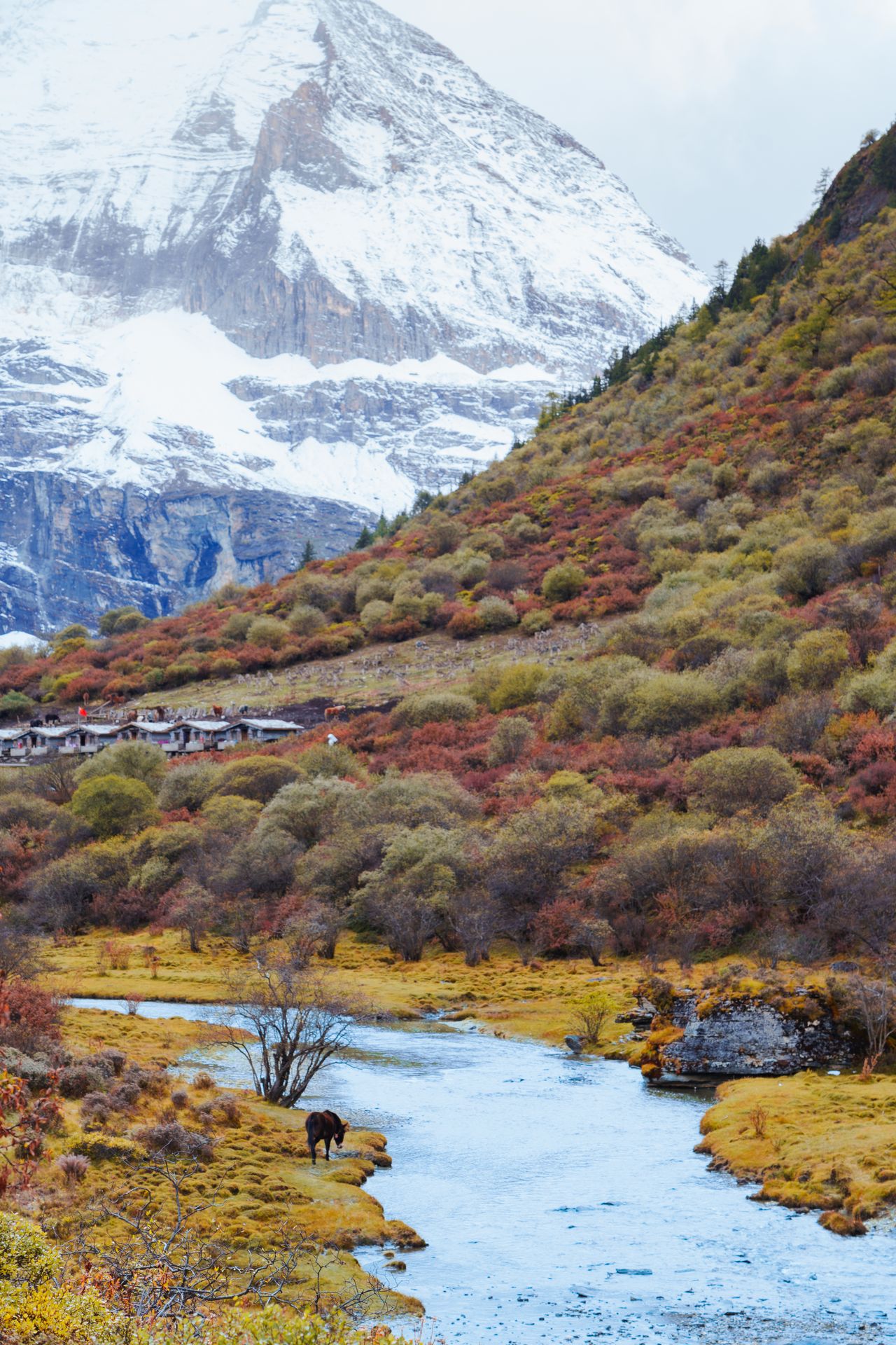
The long line runs the other way: an electric cart (or a flat, pretty 6.7 km walk) along the valley floor to Luorong Pasture at ~4,150 m, a wide meadow with a stream braided through it and all three peaks standing around it. For a great many visitors this is the right place to stop. Sit down. Have lunch. Look up.
The hard part — and permission to skip it
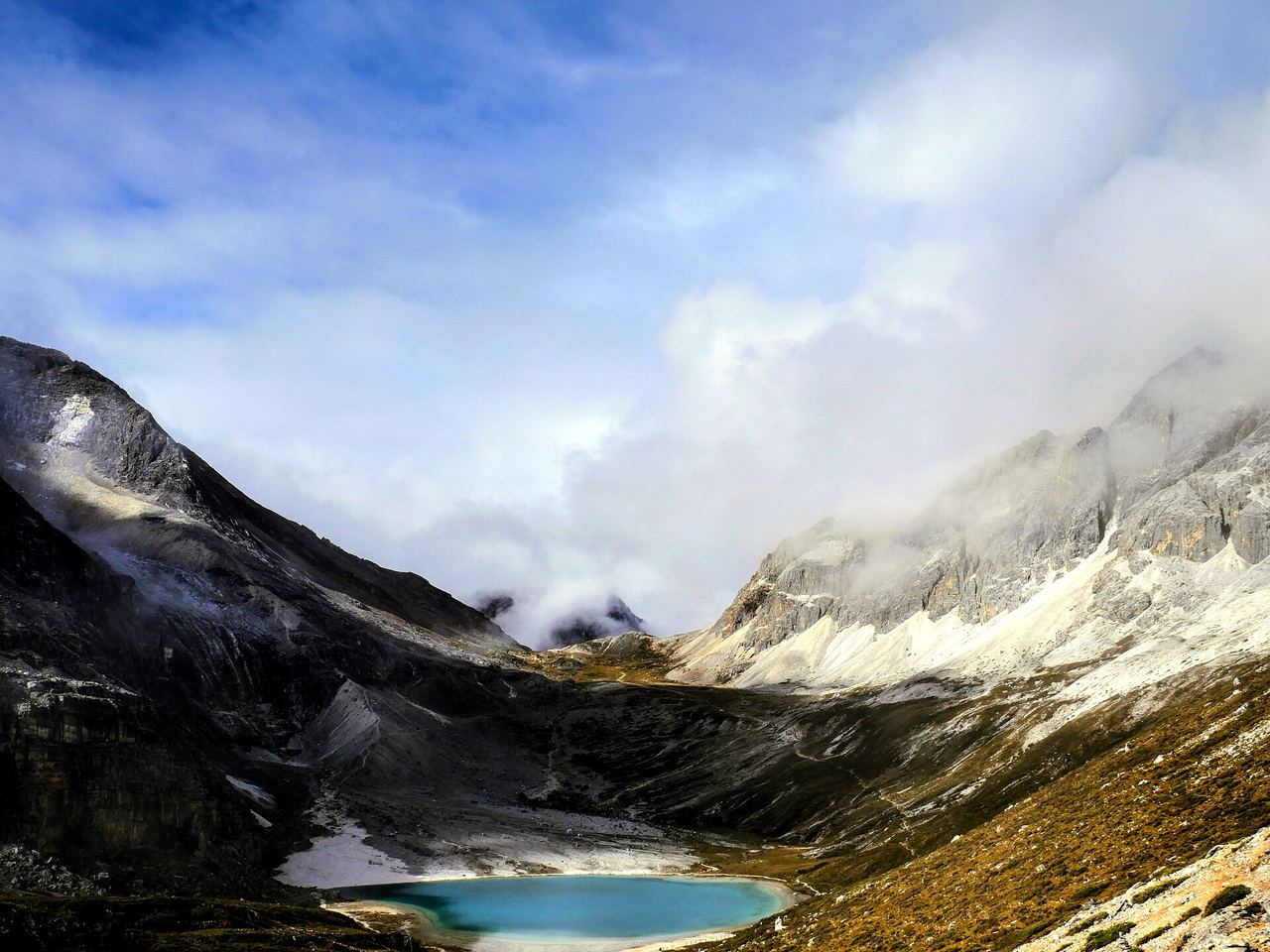
Beyond Luorong the trail goes up to Milk Sea (~4,600 m) and Five Colour Lake (~4,700 m), and this is where Yading stops being scenery and starts being an undertaking.
The plain numbers: about 5 km each way, 500–600 m of climb, and five to seven hours round trip if things go well — many people take eight to ten. All of it is above 4,000 metres, where the air holds roughly 60% of the oxygen you’re built for. The surface is gravel, mud and rock, the last couple of kilometres are steep, and the final pull between the two lakes has a local nickname that translates as “Despair Slope.” Coming down is its own punishment, on knees that have already had a day.
Horses run seasonally, roughly April to early November, around ¥300 one way — but they only go from Luorong as far as She-shen Cliff (舍身崖), about 3.5 km. The last stretch to the lakes is on your own legs, no exceptions. There are about 120 horse places a day and they’re gone by mid-morning.
There are also hard cut-off times, and rangers enforce them: no starting the high route after 14:30, and you’re expected back at Luorong by 16:00.
Now the part most guides won’t say plainly. You are allowed to turn around. Altitude is not a measure of character — it’s a lottery involving your genes, your sleep, and how fast you came up. If you get a splitting headache, nausea, or find yourself breathing hard while standing still, that is not something to walk off. Go down. Down is the medicine, and it works fast.
Carry three or four cans of oxygen (about ¥30–50 each, and much cheaper bought in town than at the trailhead), drink more water than feels reasonable, eat something, and move slower than your ego wants. Rhodiola (红景天) is what everyone in China will tell you to take, starting days before you arrive; the evidence is thin and it is no substitute for ascending slowly, but it won’t hurt you.
When to go
Late September to late October is the answer, and the colour peaks around mid-October: golden poplars down in the Daocheng valley, red grassland, fresh snow on all three peaks, and the highest proportion of clear days in the year. Skip the National Day holiday (1–7 October) unless queues are your idea of a mountain.
Spring (April–May) brings rhododendrons and heavy snow caps with a fraction of the crowds. Summer (June–August) is the monsoon — green, lush, wet, and often clouded in exactly where you want to look.
Winter matters more here than at most places, so plan around it: the high route to Milk Sea and Five Colour Lake closes, typically from late November until around mid-April. Only the short line to Pearl Lake stays open. Nights drop to −20°C, there’s black ice on the road, and some hotels shut. It’s beautiful and nearly empty — but if the high lakes are the reason you’re coming, come before mid-October.
Getting there
There is no railway to Daocheng, and there won’t be for a while. Three ways in:
By air — Daocheng Yading Airport (DCY), the 4,411 m one. Direct flights from Chengdu (about an hour), plus seasonal services from Chongqing, Xi’an, Kunming, Hangzhou and a few others; routes change, so check. Fastest, and the one that most often makes people ill. If you fly, go straight down to Shangri-La town and give yourself a night before entering the park.
By bus — from Chengdu’s Xinnanmen station, a daily long-distance bus to Daocheng, around ¥237. It is a two-day journey with an overnight stop in Kangding that you arrange yourself: roughly eight hours on day one, then a 6 am start and fourteen hours on day two. Slow, cheap, and much kinder to your body, because you gain the altitude the way a body likes to gain it. Winter services can be suspended for snow.
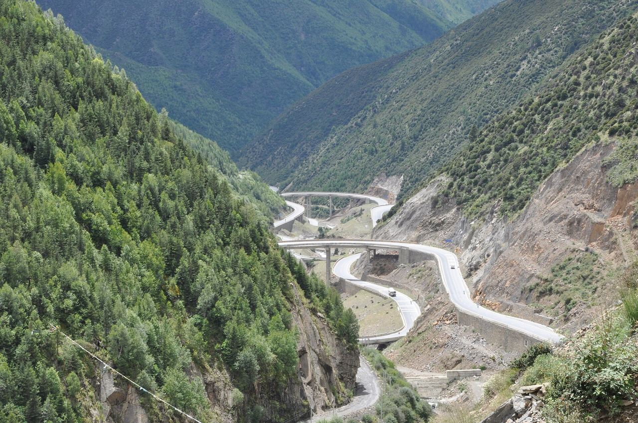
By road — Chengdu → Ya’an → Kangding → Litang on the G318, then south on the G217 to Daocheng. Two days, one of the great drives in China, and the reason half the people you meet are on motorbikes. Note that foreign visitors cannot legally self-drive in China on a foreign licence, so this means a hired car with a driver, or a tour.
One good piece of news: Yading is in Garzê Prefecture, Sichuan — not the Tibet Autonomous Region. No Tibet Travel Permit is required. Your passport and a visa (or visa-free entry) are enough, exactly as anywhere else in Sichuan. Bring the passport itself: you’ll need it to book, to enter, and to check in.
Where to sleep
This is really an altitude decision, not a comfort one.
- Shangri-La (Riwa) town, ~2,900 m — what we’d pick. Lowest, warmest, most beds, fifteen minutes from the gate. Hostel beds from ¥80–200, ordinary doubles ¥200–500, Tibetan-style and upscale places ¥600 and up. Sleeping this low is the single best altitude insurance you can buy. Many hotels advertise oxygen-supplied rooms (供氧房) in peak season.
- Yading village, ~3,900 m — the view, at a price. Inside the gate, the three peaks out the window, and you skip a shuttle ride in the morning. Rooms are simpler and dearer (¥400 off-peak to ¥800–1,200 in season, and silly money over National Day), and a thousand metres higher. Don’t make this your first night.
- Daocheng town, ~3,750 m — cheaper, but 75 km from the gate and still high. Fine as a stop on the way in, poor as a base.
Book two to four weeks ahead for July to October.
Tickets — the part that’s moving
Yading is online, real-name booking only; there’s no useful “buy at the gate.” Book through the 稻城亚丁 WeChat mini-program or an OTA (Trip.com, Ctrip, Meituan), with your passport number, and scan in at the gate. The park caps entry at 15,000 people a day, bookings open seven days ahead, and you can book until 15:00 on the day itself.
The prices, though, are genuinely in flux right now — so here’s the state of play rather than a number to memorise:
- Normal published fares: entrance ¥146 peak (15 Apr – 19 Nov) / ¥120 off-season; mandatory shuttle ¥120 return; electric cart ¥50 one way / ¥70–80 return.
- Since 29 May 2026, the shuttle and electric-cart fees have been suspended while the scenic area works through a government rectification order over charges on the provincial road it uses. This is explicitly a temporary measure pending a cost review — assume the fees can come back.
- From 1 August to 31 October 2026, the entrance ticket is free — still with real-name booking and the daily cap.
- A second day is normally much cheaper: entrance waived, shuttle at half price, on proof of the previous day’s ticket. Tickets run two days if you sleep outside the gate, three if you sleep in Yading village.
Check the mini-program in the week before you travel. That is the only number that will be true on the day. (We’ll keep the “last updated” date on this page honest.)
Rules worth knowing before you’re told
- Drones are banned. Not “discouraged” — you cannot bring a civilian drone in.
- No fire of any kind: no lighters or matches through the gate, no smoking, no stoves, no campfires.
- No camping, no pets, no leaving the boardwalks, no approaching or feeding wildlife.
- Take your rubbish down. The park runs a carry-it-out incentive scheme, and screens single-use plastic at the entrance.
- Respect the sacred sites — clockwise, hands off the prayer flags and mani stones.
And the film, since someone will ask
If you’re travelling with Chinese friends, the reason they want to come may have nothing to do with Joseph Rock. The 2016 film I Belonged to You (从你的全世界路过) put a proposal scene at Chonggu Monastery, visitor numbers jumped 20–30%, and the valley has been shorthand for grand romantic gestures ever since. It’s why you’ll see couples in matching red coats at 4,000 metres, slightly out of breath, doing a photoshoot. Enjoy it. Every generation borrows this valley for a story.
Practical tips (Yading edition)
| Thing | Our advice |
|---|---|
| Sleep low first | One or two nights at ~2,900 m in Shangri-La town before you go up. Non-negotiable if you flew in. |
| Flying vs the road | The airport is 4,411 m. The bus takes two days and treats you far better. |
| Two days in the park | Day one the short line (Pearl Lake), day two the high lakes if you feel good. Second-day entry is cheap or free. |
| The high route | ~10 km round trip, 500–600 m of climb, 5–10 hours, all above 4,000 m. Start early. |
| Cut-off times | No starting the high route after 14:30; back at Luorong by 16:00. |
| Horses | Seasonal, ~¥300, and only as far as She-shen Cliff. The last stretch is on foot. |
| Oxygen | 3–4 cans, ¥30–50 each, bought in town not at the trailhead. |
| Turning back | Always allowed. Headache, nausea or breathlessness at rest means go down, now. |
| Tickets | Real-name online booking with passport, 15,000/day cap. Fees are changing in 2026 — check the 稻城亚丁 mini-program. |
| Permits | None needed. Garzê is Sichuan, not Tibet. |
| Sun | 4,000 m sun burns through cloud. Hat, sunglasses, high-factor cream, lip balm. |
| Handy phrases | 「氧气」(oxygen), 「多少钱」(how much), 「卫生间」(restroom), 「稻城亚丁」(Daocheng Yading). |
One last thing about the name
Hilton’s Shangri-La was a place where nobody aged, nobody got tired, and nobody ever left.
Yading is the exact opposite, and better for it. It is a valley that reminds you every twenty minutes that you have a body, that the body has limits, and that the three white peaks standing over you were being walked around, clockwise and on purpose, for a thousand years before anyone thought to give them a marketable name.
Go slowly. Turn back if you need to. The mountains are not going anywhere, and they were never really called Shangri-La.
Image credits
Photos via Wikimedia Commons: Xiannairi — Toni Wöhrl and Sang Cai (CC BY-SA 4.0); Chonggu Monastery and the kora route — Michael Woodhead (CC BY-SA 2.0); Yangmaiyong and Chanadorje — Dcpeets (CC BY-SA 4.0); Luorong Pasture — Guyin Lee (CC BY-SA 4.0); Milk Sea — Izeberg007 (CC0); Five Colour Lake — rheins (CC BY 3.0); the G318 road — liuzusai 刘祖赛 (CC BY 3.0); valley view — Anders Johnson (CC BY 3.0). Via Pexels (Pexels License): Daocheng peaks — 倩 向; autumn meadow — Lin.